In March 2011 Japan was hit with the worst Tsunami in the living memory of the country, with significant loss of life and destruction on a scale very rarely seen. There was an earthquake off the coast which triggered huge waves that battered the Japanese coastline and laid waste to many town and villages in its path. Tsunamis can strike unexpectedly and without warning, as was also seen with the Indonesian events a few years earlier, but what marked out the Japanese tsunami was the fact that it was predicted and forecast using GPS due to advance warning technology.
The loss of life in Japan could have been far greater without the GPS tsunami detection warning systems that were in place as this allowed the authorities to issue warnings just moments after the first earthquake was detected. When the first tremor was felt, the GPS detection system predicted that an earthquake of 7.1 magnitude has triggered a tsunami, although this figure was later revised to be a 9 on the Richter Scale.
GPS Tsunami Early Warning System Research
Moving forward to 2012, researchers at NASA believe that GPS tsunami detection systems could actually be more accurate, and could provide faster warnings due to improvements in the technology. There is a new system in place which uses hundreds of GPS receivers placed around the Pacific Ocean and it is currently being tested for reliability and accuracy.

How the GPS receivers work is that they are in the ocean and can detect seismic movements and activity, and then transmit that data immediately to the research warning lab in one tenth of a second – so it really is lightening fast.
However, it does come with its flaws because the detection system can fail to measure high-intensity quakes that are larger than 7 – this is because stronger earthquakes shake the floor of the ocean for longer periods. So it is not ideal yet, and more work certainly needs to be done… but having the warning system in place does offer some peace of mind.
Commercial Shipping Could Help with GPS Warnings
In addition to this system being tested by NASA, there is also another method being considered in order to help with early warnings of tsunami tidal waves. The United Press International website recently reported on research being conducted at the University of Hawaii at Manoa and the National Oceanic and Atmospheric Administration’s Pacific Tsunami Warning Center.

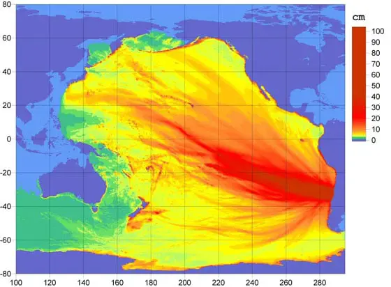
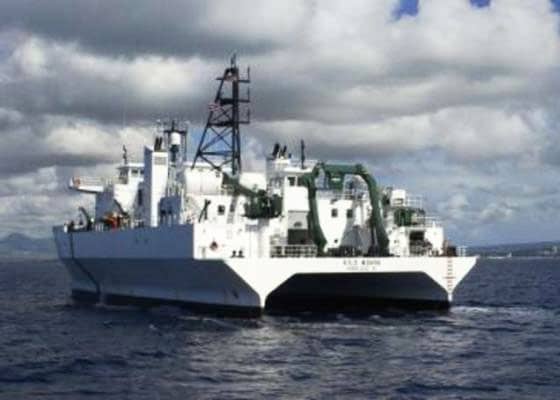
They are looking into methods where commercial ships could provide early warnings using their on-board GPS systems. A research ship was set up to see if it could detect and measure the properties of a tsunami that was produced in Maule (Chile) in February of 2010. The earthquake was 8.8 on the scale and produced a wave that was 4 inches high out on the open sea.
Whilst this might not sound significant, the research ship was able to measure this anomaly using a geodetic GPS system that was able to record data as the tsunami passed by. As a result, the scientists and researchers behind these tests now think that this kind of approach could be an invaluable asset when trying to detect and predict large destructive waves resulting from earthquakes.
James Foster who is one of the researchers at the University of Hawaii stated that:
“Our discovery indicates that the vast fleet of commercial ships traveling the ocean each day could become a network of accurate tsunami sensors. If we could equip some fraction of the shipping fleet with high-accuracy GPS and satellite communications, we could construct a dense, low-cost tsunami sensing network that would improve our detection and predictions of tsunamis whilst saving lives and money.”
It’s great to hear of these initiatives, and just go to show how GPS can be applied for many different functions other than just automotive and sporting applications. Tell us what you think about these initiatives using the Facebook Comments box below.
Tsunami Early Warning Systems using GPS
If you would like more information on this Tsunami Early Warning Detection Systems using GPS please visit the following links

