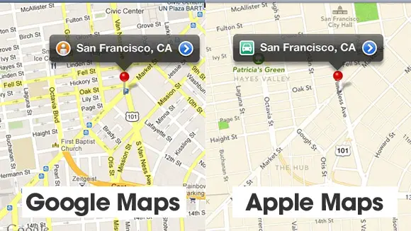
In the past both these big names in the technology industry have been facing their own share of privacy problems as issues raised by consumers and consumer rights groups have been opposing many moves made by the firms. The new matter of concern is regarding the map apps race in which Google and Apple are both now trying to develop their own mapping solution for their smart phones.
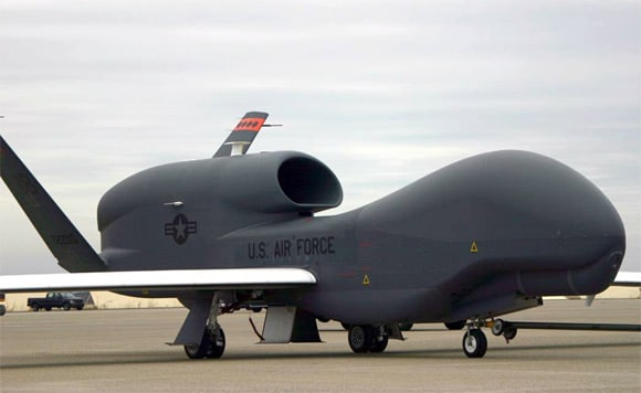
In the past Google was the dominant firm and had the upper hand as it simply used it Google maps service and integrated this with Android, Apple was also using this service with some modification. Now however Apple has decided to launch its very own mapping service with iPhone 5 and in doing so, Google has also had to take it up a notch. It is reported that now both Google and Apple are making use of military grade weaponry and technology in the form of spy planes in order to get the best images for its own map.

Apple and Google Using Spy Plane Technology for Mapping
So far the two companies have been using these spy planes to photograph the more populated parts of the United States of America which include big cities, towns and the urban area in general. This whole activity of capturing the country from the skies has gathered a lot of attention from various people such as senators. As with many other cases and matters that have cropped up in history there are some in favor of this and others who are against it, a senior official from a news firm was not very happy to hear what the two firms were up to and this led him to communicate with the firms about the matter. Apple and Google have each received a letter about the matter and when addressing the public the official said that these technology giants are indeed invading consumer privacy and rights.

Considering the fact that the equipment they are using is extremely powerful and what they are doing is rather dangerous can leave consumers completely vulnerable – not to mention the fact that consumers cannot do much about this. This magnitude of the problem is better understood when you realize exactly how powerful this spy plane equipment is as both the companies are making use of planes which are capable of capturing detailed images of houses… and not only the house, but can also look in through windows with great clarity. From thousands of feet up in to the sky the cameras in these spy planes are capable of getting a good view of the tiniest things, bringing you high quality images of your backyard cookout you had this weekend.
Mapping Apps to Include 3D Images in the Future
The reason why equipment needs to be of such high precision and quality is that the two firms are now looking to develop a mapping system which is far more superior to the one they had in place in the past. The new maps that are yet to be launched are supposed to deliver three dimensional images of urban areas, major cities and city centers.
According to the two technology giants turned smart phone giants, these images and maps should not be a concern for consumers. Google stated that the resolution of the photo’s which it captures is not that high and hence does not provide enough clarity for the images and maps to be something to worry about. On the other hand Apple went on to mention that the images that it creates are not published in its raw form and are in fact edited to remove moving things such as people and cars, which removes details such as faces and license plates.
Author Bio: James Clark’s work revolves around tracking apps and software. His most recent stint in Cell Phone Monitoring has focused on Spy Software for iPhone. Clark’s readers follow this work to get the latest scoop on all things tracking.

